Import locations
Excel file imports can be used either for creating new nodes or for updating existing ones. Please see the Import content page for more general info.
To download the template file (for new data or for updating your data)
- Go to Import > Nodes > Excel file import
- Choose locations from the second drop-down menu
- Choose the template file you wish to work on (choose the first for creating new data or the second for changing or amending existing scratchpad data)
- Open the downloaded excel file in your computer and edit it
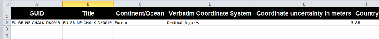
Complete the columns as follows:
- GUID:
Use Global Unique Identifiers for each one of your localities. These identifiers will not show up to users. Use complex combinations like EU-GB-S-DK-000-001
- Title:
The title is the location identifier and will be used to refer to each specific location in your scratchpad. Make it human readable.
- Continent/Ocean:
Select the continent or Ocean of your locality. Choose one from the following: Africa, Antarctic, Asia-Temperate, Asia-Tropical, Atlantic Ocean, Australasia, Europe, Indian Ocean, North-Central Pacific, Northern America, Northwestern Pacific, Pacific, South-Central Pacific, Southern America, Southwestern Pacific
- Verbatim Coordinate System:
Provide the name of the system the coordinates of the locality were recorded. Choose one from the following: decimal degrees, degrees decimal minutes, degrees minutes seconds, UTM, CRTM.
- Coordinate uncertainty in meters:
The upper limit of the distance (in meters) from the given latitude and longitude describing a circle within which the whole of the described locality lies. Leave the value empty if the uncertainty is unknown, cannot be estimated, or is not applicable (because there are no coordinates). The value should be greater than zero.
- Country (ISO alpha-2):
Choose the administrative region (Country) the locality is in. Please fill in the the official ISO 3166-1-alpha-2 country code. An exhaustive list can be found here.

- County:
Provide the the name of a second-level administrative subdivision of a country.
- Geodetic datum:
Provide the geodetic datum of the locality coordinates. e.g. WGS84, NAD83, NAD27 etc.
- Georeference protocol:
Give a citation (publication or URL) to the resource describing the methods used to determine the georeference (coordinates AND uncertainty, or footprint)
- Georeference remarks:
Comments about the spatial description determination, explaining assumptions made in addition or opposition to the those formalized in the method referred to in Georeference Protocol.